
What Is El Niño and Why Is 2026 Different?
The World Meteorological Organization (WMO) issued a stark warning on June 2, 2026, confirming that El Niño conditions are rapidly developing in the tropical Pacific Ocean. With an 80% probability of emergence between June and August, rising to roughly 90% by November, this climate phenomenon is expected to disrupt global weather patterns, fuel extreme events, and push global temperatures higher. Unlike recent La Niña years, which had a temporary cooling effect, the coming El Niño 2026 threatens to be one of the strongest on record, with sea surface temperature anomalies potentially exceeding 3°C in some regions.
El Niño is the warm phase of the El Niño-Southern Oscillation (ENSO), a natural climate pattern driven by interactions between ocean temperatures and atmospheric winds in the equatorial Pacific. During El Niño, trade winds weaken, allowing warm surface waters to shift eastward toward the coast of South America. This disrupts normal weather patterns worldwide, causing droughts in some regions and floods in others.
WMO and UN Issue Urgent Call to Action
WMO Secretary-General Celeste Saulo emphasized the gravity of the situation: 'We must prepare for a potentially strong El Niño, which will exacerbate drought and heavy rainfall and increase the risks of heatwaves on land and in the ocean.' The WMO's El Niño/La Niña Update for June-August 2026 highlights that the tropical Pacific Ocean is already showing subsurface temperature anomalies of up to 8°C above normal — a signal that historically precedes very strong events.
UN Secretary-General António Guterres called the development an urgent climate warning: 'The science is clear. El Niño is at our doorstep with 90% certainty. The world must treat this as the urgent climate warning it is. El Niño will pour fuel on the fire of a warming world.' The UN stressed that while climate change does not make El Niño more frequent, it amplifies its impacts by adding more energy and moisture to the atmosphere, making heatwaves more intense and rainfall more extreme.
What Makes This El Niño Potentially Historic?
Record Ocean Temperatures
Current observations show that sea surface temperatures in the Niño 3.4 region — the key monitoring zone — are already 1.5-2°C above average, with some models predicting anomalies exceeding 2.5°C by autumn. This would place the 2026 event in the same category as the super El Niños of 1997-98 and 2015-16, and possibly rival the devastating 1877-78 event that triggered global famines. The global climate change 2026 context amplifies concerns: the planet just experienced its hottest year on record in 2024, and 2025 was the second hottest. A super El Niño on top of this warming baseline could shatter temperature records.
Rapid Onset and Strong Model Agreement
NOAA's Climate Prediction Center upgraded the ENSO Alert Status to El Niño Watch on May 14, 2026, citing a massive downwelling Kelvin wave with subsurface anomalies up to +8°C and rare westerly wind bursts from a triplet of tropical cyclones. Multiple models — including NMME, CFSv2, and ECMWF — show strong agreement, with some ensemble members exceeding +4°C anomalies. Scientists caution about the Spring Predictability Barrier but note unusually strong alignment in observed and modeled data.
Regional Impacts: Where Will the Extremes Hit?
Drought and Food Security Threats
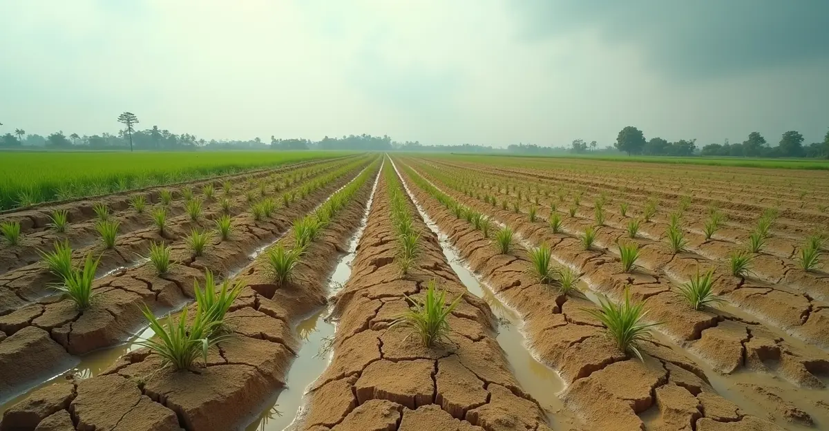
El Niño typically brings drier conditions to Central America, the Caribbean, Australia, Indonesia, and parts of Asia. The Horn of Africa, already reeling from multiple failed rainy seasons, faces below-normal rainfall, deepening the humanitarian crisis. South Asia's monsoon is expected to be weaker, threatening agriculture and water resources for billions. 'El Niño-driven extremes act as threat multipliers,' warned Kaveh Madani of the UN University Institute for Water, Environment and Health. 'They worsen vulnerabilities far beyond what we saw in the 20th century, especially in regions already in water bankruptcy.'
The global food supply chain 2026 is particularly vulnerable. Drought conditions could reduce maize, rice, and wheat production in Asia and Australia, while wet conditions may boost soybean production in the Americas. Analysts warn that the combination of El Niño-driven crop losses and geopolitical tensions could disrupt maritime trade routes, including the Panama Canal, where low water levels already constrain shipping capacity.
Flooding and Heavy Rainfall
Western South America — particularly Ecuador, Peru, and parts of Brazil — typically experiences above-average rainfall during El Niño, raising the risk of flash floods and landslides. The southern United States also tends to be wetter, while the northern US and Canada often see milder, drier winters. In the Caribbean and Central America, drier conditions prevail, increasing the risk of water shortages and wildfires.
Tropical Cyclone Activity
El Niño alters hurricane patterns significantly. Warmer Pacific waters boost cyclone formation in the central and eastern Pacific, potentially threatening Hawaii and the west coast of Mexico. Conversely, increased wind shear over the Atlantic typically suppresses hurricane development, offering some relief to the US East Coast and the Caribbean — though this is no guarantee, as the 2023 Atlantic season showed.
Economic and Humanitarian Consequences
The 2023-24 El Niño, one of the five strongest on record, contributed to 2024 becoming the hottest year in history. The 2026 event could be even more disruptive. The economic impact of extreme weather 2026 is expected to be severe, with potential losses in agriculture, infrastructure, and energy sectors. Hydropower generation may be strained in drought-affected regions, while mining operations in South America and Australia could face water shortages.
WMO and partner agencies are urging governments to invest in early warning systems and preparedness measures. 'Accurate forecasts and early warnings are critical for preparedness,' Saulo said. 'They enable communities, humanitarian agencies, and governments to take early action to protect lives, property, agriculture, and infrastructure.' The WMO remains committed to monitoring conditions closely in the coming months to provide updated guidance.
FAQ: El Niño 2026
What is El Niño?
El Niño is the warm phase of the El Niño-Southern Oscillation (ENSO), characterized by above-average sea surface temperatures in the central and eastern tropical Pacific Ocean. It occurs every 2-7 years and typically lasts 9-12 months.
How strong will the 2026 El Niño be?
Most models predict at least a moderate event, with a high probability of becoming strong (anomalies >1.5°C) or even super El Niño status (anomalies >2.0°C). Some ensemble members show anomalies exceeding 4°C, which would be unprecedented in modern records.
When will El Niño peak?
El Niño typically peaks between November and February. The 2026 event is expected to reach maximum intensity in late 2026, with effects persisting through 2027.
How will El Niño affect global temperatures?
El Niño adds heat to the climate system, typically raising global average temperatures by 0.1-0.2°C. Combined with long-term warming from climate change, 2026 or 2027 could become the hottest year on record.
Can El Niño be predicted accurately?
Seasonal forecasts are highly reliable once conditions develop. The WMO's June update shows strong model agreement, but there is always uncertainty around the exact intensity and duration. The Spring Predictability Barrier makes early forecasts less certain, but confidence increases as the event matures.
Sources
- World Meteorological Organization (WMO) El Niño/La Niña Update, June 2, 2026
- United Nations News, June 2026
- NOAA Climate Prediction Center, May 2026


Follow Discussion