
What is Celeste LEO Navigation?
On April 8, 2026, the European Space Agency achieved a historic milestone when engineers at ESTEC's Navigation Lab in Noordwijk, Netherlands, received the first-ever navigation signal transmitted from low Earth orbit (LEO). This groundbreaking achievement by ESA's Celeste mission represents Europe's first successful demonstration of satellite navigation from LEO, opening the door to revolutionary positioning capabilities including indoor GPS navigation that could transform how we navigate in urban environments, remote areas, and even inside buildings.
From Launch to Signal: The Celeste Mission Timeline
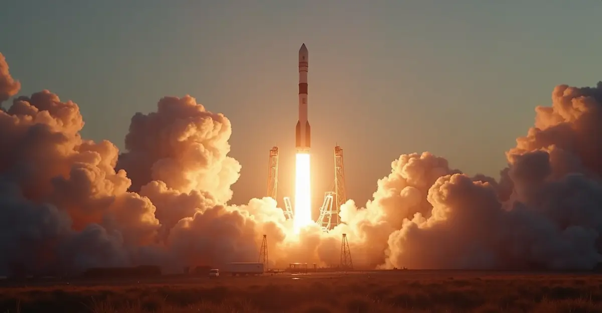
The Celeste mission began with the launch of two CubeSats on March 28, 2026, aboard a Rocket Lab Electron rocket from New Zealand's Māhia launch complex. The satellites – a 12U model built by GMV (Spain) and a 16U model from Thales Alenia Space (France/Italy) – separated from the rocket approximately one hour after launch. Just 11 days later, on April 8, ground teams at ESTEC captured the inaugural navigation signal, marking what ESA Director-General Josef Aschbacher called 'a new frontier for European satellite navigation.'
'With this mission, we're exploring new boundaries for satellite navigation,' Aschbacher stated. 'Celeste demonstrates how a constellation in low Earth orbit can complement Europe's current Galileo system.'
Why Low Earth Orbit Matters for Navigation
Traditional navigation systems like Galileo GPS satellites operate in medium Earth orbit (MEO) at approximately 23,222 kilometers altitude. Celeste's LEO satellites orbit much closer to Earth – between 500 and 1,000 kilometers – providing several critical advantages:
- Stronger Signals: Proximity to Earth means signals are up to 100 times stronger than MEO signals
- Indoor Navigation: Enhanced signal penetration enables positioning inside buildings
- Urban Canyon Performance: Better reception in cities with tall buildings
- Faster Satellite Motion: Improved vertical positioning accuracy
- Jamming Resistance: Enhanced security against signal interference
LEO vs MEO: The Navigation Revolution
The fundamental difference between LEO and MEO navigation comes down to physics. Satellites in low Earth orbit complete orbits every 90-120 minutes, moving rapidly across the sky compared to MEO satellites' 12-hour orbits. This faster motion provides more geometric diversity for positioning calculations, while the shorter distance dramatically increases signal strength.
Francisco-Javier Benedicto Ruiz, ESA's Navigation Director, explained: 'Celeste shows how a complementary LEO layer can make current navigation systems more resilient and functional while enabling entirely new services.'
Technical Specifications and Frequency Bands
The Celeste demonstrators are testing navigation signals across multiple frequency bands including L-band (1-2 GHz) and S-band (2-4 GHz), with plans to explore C-band and UHF frequencies. This multi-frequency approach allows for:
- Reduced atmospheric interference
- Enhanced accuracy through signal combination
- Backup capabilities if one frequency is compromised
- Compatibility with existing smartphone navigation technology
The Future: 11-Satellite Constellation and European Resilience
The current two-satellite demonstration is just the beginning. By 2027, ESA plans to expand the Celeste constellation to 11 operational satellites that will conduct comprehensive testing of:
- Different frequency band combinations
- Various user environments and applications
- Autonomous orbit determination without ground infrastructure
- Integration with existing Galileo and EGNOS systems
This expansion is part of ESA's broader European Resilience from Space (ERS) initiative, approved at the 2025 Ministerial Council with €1.2 billion in funding. The program aims to strengthen Europe's strategic space capabilities and reduce dependence on foreign navigation systems.
Practical Applications: From Smartphones to Emergency Services
The implications of successful LEO navigation are profound. Users could experience:
| Application | Current Limitations | Celeste LEO Improvement |
|---|---|---|
| Indoor Navigation | GPS signals blocked by buildings | Penetration through walls and roofs |
| Urban Positioning | Signal reflection in 'urban canyons' | Direct line-of-sight signals |
| Autonomous Vehicles | Inconsistent positioning accuracy | Continuous centimeter-level precision |
| Emergency Services | Limited coverage in remote areas | Global coverage including polar regions |
How to Track Navigation Satellites Yourself
Curious users can already monitor which navigation satellites their devices are using with free apps:
- GNSS Status (Android): Shows satellite networks (GPS, Galileo, GLONASS, BeiDou) with signal strength and position data
- GPSTest (Android): Provides detailed satellite information and supports latest GNSS features
- GNSS View (iOS): Displays all major navigation networks in a sky view format
These apps demonstrate how modern smartphones already combine signals from multiple navigation systems – a capability that will expand to include LEO signals as Celeste technology matures.
Frequently Asked Questions
What makes Celeste different from existing GPS?
Celeste operates from low Earth orbit (500-1,000 km) instead of medium Earth orbit (23,222 km), providing stronger signals that work indoors and in challenging urban environments.
When will Celeste navigation be available on smartphones?
Consumer availability depends on the 2027 demonstration results and subsequent EU decisions about operational deployment. Smartphone manufacturers would need to add LEO frequency support, likely by 2028-2030.
How does Celeste complement Europe's Galileo system?
Celeste provides a complementary layer to Galileo, enhancing signal strength, coverage in difficult areas, and overall system resilience against interference or failure.
Can Celeste work without internet connection?
Yes, like traditional GNSS systems, Celeste navigation signals work independently of internet connectivity, making them valuable for emergency and remote applications.
What are the security implications of LEO navigation?
LEO navigation offers enhanced security through stronger signals that are more resistant to jamming and spoofing, plus the ability to use multiple frequency bands for redundancy.
Sources
ESA Celeste Mission Page
Wikipedia: Celeste LEO-PNT
Phys.org: ESA Celeste First Signal
Inside GNSS: Celeste Signal Transmission


Follow Discussion