
 Nederlands
 English
 Deutsch
 Français
 Español
 Português


Global Methane Observatory Revolutionizes Emission Tracking
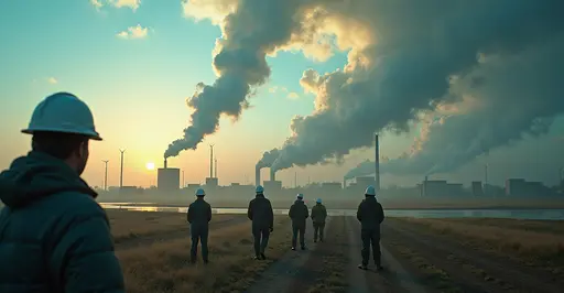
A groundbreaking satellite network is now providing unprecedented real-time monitoring of methane leaks worldwide. The International Methane Emissions Observatory (IMEO), launched by UN Environment Programme, uses advanced sensors to detect greenhouse gas emissions from oil and gas facilities, coal mines, and agricultural operations. This system delivers data within hours of detection, enabling rapid response to major leaks.
Why Methane Matters
Methane accounts for approximately 30% of global warming since the Industrial Revolution. Though shorter-lived than CO2, it's 80 times more potent at trapping heat during its first 20 years in the atmosphere. Recent studies show human activities generate 360 million tons annually, primarily from fossil fuels (33%), livestock (30%), and waste (18%).
How the Satellite System Works
The Methane Alert and Response System (MARS) combines data from multiple satellites including specialized methane detectors. When significant plumes are detected, automated alerts notify governments and companies. California recently launched its own state-level satellite network in March 2025, setting a new standard for regional monitoring.
Impact on Climate Efforts
This technology supports the Global Methane Pledge signed by 150 countries aiming for 30% reductions by 2030. Recent findings revealed Australian coal mines emitting 3-8 times more methane than reported, demonstrating the system's importance. "We have the data; now we need action," says IMEO head Manfredi Caltagirone.
Future Developments
The network will expand with new satellites launching in 2026, increasing detection sensitivity to identify smaller leaks. Training programs are underway in Angola, Libya, and other nations to build local response capacity. The technology could prevent 0.3°C of warming by 2050 if fully implemented.