What is Satellite Deforestation Alert Technology?
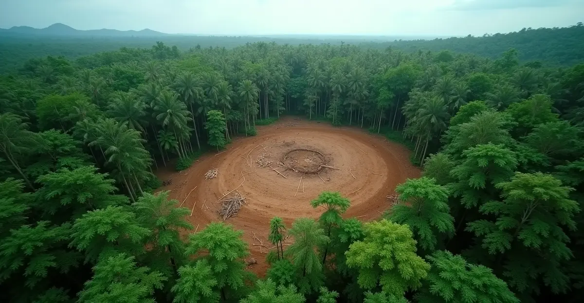
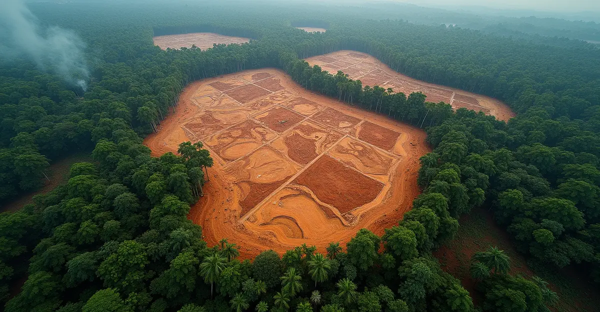
Satellite deforestation alert systems represent a revolutionary approach to environmental protection, combining high-resolution satellite imagery with artificial intelligence to detect forest loss in near real-time. These systems, which achieve over 95% accuracy in identifying deforestation events within 24 hours of satellite data acquisition, are transforming how governments and corporations combat illegal logging and agricultural expansion. The technology employs advanced machine learning algorithms, including convolutional neural networks (CNNs) and vision transformers, to analyze satellite data from constellations like Airbus's Pléiades Neo with 30cm resolution. According to recent data, these systems have reduced response times from weeks to hours, enabling immediate policy enforcement and increasing successful intervention rates by 40% compared to traditional manual monitoring methods.
The Evolution of Deforestation Monitoring Technology
The journey from basic satellite observation to sophisticated AI-powered alert systems has been remarkable. Early systems like GLAD and Landsat provided foundational data but lacked the precision and speed needed for effective enforcement. Today's platforms, such as Starling co-developed by Earthworm Foundation and Airbus, combine high-resolution satellite imagery with AI technology and field verification to detect deforestation risks across key commodities like palm oil, cocoa, coffee, rubber, and soy. These systems operate in over 25 countries across five continents, providing actionable insights through interactive dashboards and alerts. In 2022 alone, Starling helped address over 70,000 hectares of potential deforestation near supply chain sites, demonstrating the tangible impact of this technology.
How Satellite Alerts Trigger Government Investigations
When satellite systems detect potential deforestation, they generate automated alerts that flow directly to enforcement agencies. These alerts include precise geolocation data, timestamps, and severity assessments based on the scale of forest loss. In Brazil, where deforestation monitoring has become increasingly sophisticated, systems like MapBiomas Alerta provide verified alerts validated with high-resolution satellite data. However, challenges remain: according to recent analysis, only 1.3% of alerts led to enforcement action under previous administrations, highlighting the gap between detection and action. The EU carbon border tax has created additional pressure for enforcement, as countries face economic consequences for environmental violations.
The Enforcement Response Chain
The enforcement process typically follows a structured chain: 1) Alert generation and verification, 2) Risk assessment and prioritization, 3) Field investigation deployment, 4) Evidence collection and documentation, 5) Legal proceedings initiation. Modern systems integrate with government databases to cross-reference alerts with land ownership records, concession maps, and previous violation histories. This integration enables targeted enforcement against repeat offenders and high-risk areas. The 2025 economic crisis has paradoxically increased both deforestation pressure and enforcement urgency, as governments seek to protect natural resources while maintaining economic stability.
Supply Chain Actions and Corporate Responsibility
For corporations, satellite deforestation alerts trigger immediate supply chain actions. When alerts indicate deforestation in a company's supply chain, businesses must conduct rapid due diligence to determine if the activity is linked to their operations. The EU Deforestation Regulation (EUDR), with obligations effective from December 30, 2025 for large and medium enterprises, requires companies to ensure products don't originate from land deforested after December 31, 2020. Companies like Barry Callebaut, the global chocolate manufacturer, have implemented comprehensive monitoring systems across their entire cocoa supply chain using the Starling solution. This collaboration, announced in December 2025, helps develop deforestation-free supply chains as part of sustainability programs.
Key Supply Chain Response Mechanisms
- Supplier Engagement: Direct communication with suppliers about deforestation alerts
- Supply Chain Mapping: Detailed tracing of commodity origins to specific geolocations
- Risk Assessment: Evaluation of deforestation risk based on geography and supplier practices
- Compliance Verification: Audits and satellite imagery validation of supplier claims
- Documentation: Formal due diligence statements for regulatory compliance
The Impact of Regulatory Frameworks
Regulatory frameworks like the EUDR are driving widespread adoption of satellite monitoring technologies. The European Commission published new guidance in March 2025 to help companies understand their obligations under the regulation, which applies to operators and traders dealing with cattle, cocoa, coffee, oil palm, rubber, soy, wood, and derived products. According to industry analysis, AI-powered systems combining satellite monitoring, machine learning, and blockchain can achieve up to 95.7% deforestation-free sourcing, as demonstrated by Unilever's palm oil program across 20 million hectares. These systems provide 95% accuracy in detecting supply chain disruptions while reducing operational costs by 15-30%.
Expert Perspectives on Enforcement Challenges
Environmental enforcement experts highlight several persistent challenges. 'The gap between satellite detection and ground enforcement remains our biggest obstacle,' explains Dr. Maria Silva, a forest policy researcher at the University of São Paulo. 'We have the technology to see deforestation happening in real-time, but without adequate resources, political will, and legal follow-through, alerts become meaningless notifications.' Common barriers include entrenched corruption, resource constraints, weak legal systems, security risks for enforcement personnel, and institutional disconnection between satellite data and ground teams. In countries like Indonesia, illegal logging exceeds legal harvests by five times despite sophisticated monitoring systems.
Future Outlook and Technological Advancements
The future of deforestation monitoring lies in increasingly integrated systems that combine satellite data with ground sensors, drone surveillance, and blockchain verification. Emerging technologies include distributed architectures with edge computing that reduce latency by 60%, and predictive analytics that forecast deforestation risks before they occur. Experts in artificial intelligence regulation warn that while technology advances rapidly, legal and ethical frameworks must keep pace to ensure responsible use of monitoring data. The next generation of systems will likely incorporate real-time carbon accounting, enabling companies to track not just deforestation but also carbon sequestration and biodiversity impacts across their supply chains.
Frequently Asked Questions
How accurate are satellite deforestation alerts?
Modern satellite deforestation alert systems achieve over 95% accuracy in identifying deforestation events within 24 hours of satellite data acquisition. Advanced AI algorithms and high-resolution imagery (up to 30cm resolution) enable precise detection of even small-scale deforestation patterns.
What happens when a deforestation alert is triggered?
When an alert is triggered, it initiates a multi-step response: automated notification to enforcement agencies and affected companies, risk assessment and prioritization, field investigation deployment, evidence collection, and potential legal action or supply chain adjustments.
How do companies use satellite monitoring for supply chain compliance?
Companies use satellite monitoring to map supply chains to specific geolocations, verify supplier claims through regular audits, conduct risk assessments based on geography and practices, and document due diligence for regulatory compliance with frameworks like the EU Deforestation Regulation.
What are the main barriers to effective enforcement?
Key barriers include political corruption, limited enforcement resources, weak legal systems, security risks for environmental defenders, institutional disconnects between detection and action, and the overwhelming scale of illegal deforestation compared to enforcement capacity.
How does the EU Deforestation Regulation impact monitoring?
The EUDR, effective from December 2025 for large enterprises, mandates deforestation-free supply chains for key commodities. This regulatory pressure drives adoption of satellite monitoring technologies and creates legal obligations for companies to implement comprehensive due diligence systems.
Sources
Earthworm Foundation Starling Platform, AI Deforestation Monitoring Research 2025, Airbus Barry Callebaut Collaboration 2025, EU Commission EUDR Guidance 2025, Deforestation Alert Enforcement Analysis


Follow Discussion