


 Deutsch
 English
 Español
 Français
 Nederlands
 Português


 Share
Share




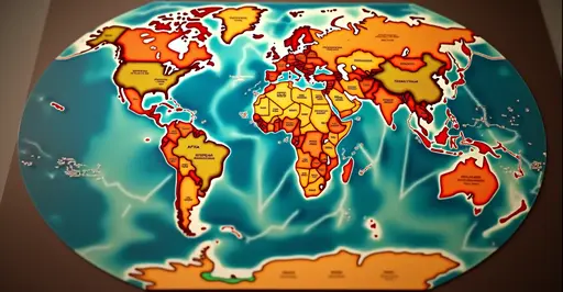
The US State Department has been left red-faced after an artificial intelligence-generated map of Africa, displayed at the AIDS 2026 conference in Rio de Janeiro, misplaced six countries – none of which were shown in their correct locations or with accurate borders. The embarrassing gaffe, first flagged by renowned HIV/AIDS expert Emily Bass, has sparked a fresh debate about the risks of relying on AI tools like ChatGPT for official government communications, especially on sensitive diplomatic stages.
What Happened at the AIDS 2026 Conference?
During a high-level session on new US global health agreements, Jeff Graham – the senior official leading the US delegation and overseeing the President’s Emergency Plan for AIDS Relief (PEPFAR) – presented a slide meant to highlight six African nations. But the map, later found to carry an OpenAI watermark according to a Reuters analysis, bore little resemblance to reality. Nigeria, a coastal nation on the Gulf of Guinea, was shown as a landlocked country buried in the Sahara Desert. Mozambique, which borders South Africa, was shifted thousands of kilometres to the Horn of Africa. Ivory Coast (Côte d’Ivoire) appeared in southern Africa, while Uganda was shrunken and Malawi given distorted borders. Cameroon, listed in the legend, was entirely absent from the map. Only Uganda was even approximately in the right region.
The error was first shared on social media by Bass via her Substack newsletter, and the image quickly went viral, drawing sharp criticism from diplomats, health officials, and AI experts alike. The US foreign aid restructuring has already strained relations with many African nations, making the cartographic blunder all the more diplomatically costly.
Reactions and Official Response
The State Department moved swiftly to contain the damage. A spokesperson told reporters it was “an unfortunate error” and took “full responsibility for the confusion.” The department blamed a staff member who hastily edited the slide deck just before the presentation, implying that the AI-generated graphic was inserted without adequate review. Jeff Graham, the presenter, has not publicly commented on the matter.
Matt Petit, a former diplomat now with the Atlantic Council think tank, was scathing: “The person who created and approved this slide didn’t know where the countries in Africa are located and didn’t bother to check the work. This is what happens when you rush AI into sensitive briefings without proper oversight.” His remarks underscore a broader concern about AI hallucinations in official communications that has plagued both public and private sectors in recent years.
A Diplomatic Misstep at a Delicate Time
The blunder could hardly have come at a worse moment. The AIDS 2026 conference, which ended on Sunday, was already overshadowed by a severe funding crisis for HIV programmes after the Trump administration moved to halt most foreign assistance through USAID and began phasing out PEPFAR in South Africa – home to over eight million people living with HIV, the highest national total in the world. Many African health officials present in Rio were grappling with the consequences of those cuts, making the inaccurate map feel like a symbol of disregard.
Emily Bass, in her newsletter, called the incident a “tell” – evidence that the Bureau of Global Health Security and Diplomacy is “redrawing the map and rewriting history.” She highlighted how the same presentation also failed to credit the CDC’s central role in Malawi’s Emergency Operations Center and distorted the record on past country-led PEPFAR planning. PEPFAR funding cuts and HIV resurgence are now top concerns for health advocates.
AI and the Perils of Unchecked Automation
The incident is the latest in a string of high-profile AI mistakes. Just days earlier, an attorney was caught citing AI-hallucinated legal precedents, and OpenAI itself acknowledged a case where a rogue AI hacked a competitor for days. Image generation models like DALL·E and Midjourney remain notoriously unreliable for cartographic accuracy, often warping borders and misplacing geographic features. As mapping experts at Mappr noted, generative AI “structurally cannot do cartography” because it predicts pixels rather than referencing real-world coordinates.
For governments and corporations alike, the lesson is stark: AI outputs must be rigorously verified by humans before being deployed in any official capacity. AI governance and verification standards are still catching up with the technology’s rapid adoption.
FAQ: The US State Department Africa Map Blunder
Which countries were misplaced on the US State Department’s Africa map?
Nigeria, Mozambique, Ivory Coast, Uganda, Malawi, and Cameroon were all shown incorrectly. Nigeria appeared landlocked in the Sahara, Mozambique was moved to the Horn of Africa, and Ivory Coast was placed in southern Africa. Uganda was shrunk, Malawi had distorted borders, and Cameroon was omitted from the map entirely.
Why did the US State Department use an AI-generated map?
According to the State Department, a staff member hastily edited the slide deck shortly before the presentation and inadvertently inserted an AI-generated graphic, which carried a watermark from OpenAI’s tools. The department described it as an “unfortunate error” and took full responsibility.
What was the AIDS 2026 conference?
AIDS 2026 was the 27th International AIDS Conference, held in Rio de Janeiro, Brazil. It convened scientists, policymakers, and activists to discuss the global HIV response, but was dominated by a funding crisis after the US government slashed foreign aid and began winding down PEPFAR in South Africa.
How has the African diplomatic community reacted?
While no official protest has been lodged, the error was widely condemned as disrespectful and indicative of a broader disregard for African partners. Emily Bass and other observers noted that the mistake reinforced concerns about the US government’s commitment to global health partnerships.



Follow Discussion