Mexico City Is Sinking Up to 2 cm Per Month, NASA Satellite Data Shows
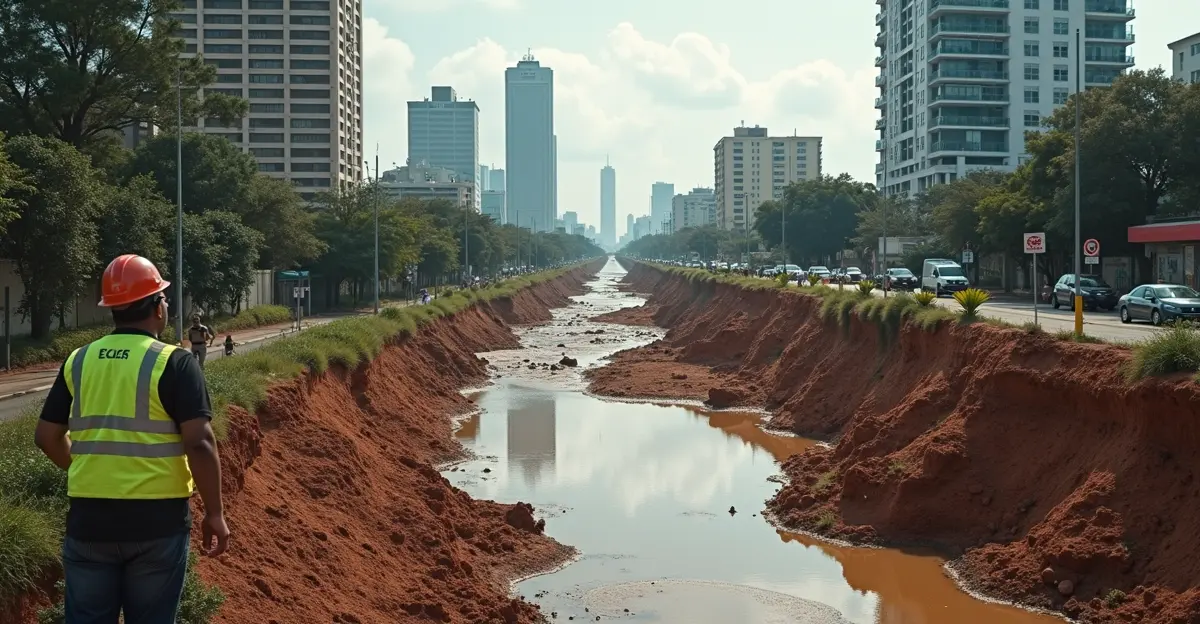
New data from the NASA-ISRO NISAR satellite reveals that Mexico City is sinking at an alarming rate of more than 2 centimeters per month in some areas, making it one of the fastest-sinking capital cities on Earth. The joint US-Indian space mission, launched in July 2025, has mapped extreme land subsidence across the metropolitan area of 22 million people, confirming what residents have experienced for decades: the ground beneath their feet is steadily giving way.
Using advanced L-band synthetic aperture radar, NISAR tracked ground movements between October 2025 and January 2026, detecting subsidence rates as high as 35 to 50 centimeters per year in the most vulnerable districts. The findings, published by NASA in May 2026, show that the problem is accelerating due to a vicious cycle of groundwater over-extraction and infrastructure damage.
What Is Causing Mexico City to Sink?
Mexico City was built on the soft clay bed of the former Lake Texcoco. The city's aquifer, which provides approximately 60% of its drinking water, lies beneath this ancient lakebed. As groundwater is pumped out at rates far exceeding natural recharge, the clay compacts irreversibly under the immense weight of the city's buildings and infrastructure.
The water table is currently dropping by about 40 centimeters per year. Since the first subsidence measurements in 1925, some areas of the city have sunk by more than 9 meters (30 feet). The problem is compounded by the fact that the sinking is uneven — a phenomenon known as differential subsidence — which causes buildings, roads, and metro lines to tilt and crack.
Similar to the global land subsidence crisis, Mexico City's situation is exacerbated by rapid urbanization and climate change, which intensifies drought conditions and reduces water availability.
Key Areas Affected by Subsidence
The NISAR data reveals stark differences across the city. While some neighborhoods remain relatively stable, others are dropping at breathtaking speeds.
- Benito Juárez International Airport: One of the worst-hit areas, sinking by more than 2 cm per month, threatening runway integrity and airport operations.
- Nabor Carrillo Lake region: Experiencing accelerated subsidence of up to 50 cm per year.
- Historic downtown: The Metropolitan Cathedral and other colonial-era buildings show visible tilting.
- Paseo de la Reforma: The iconic Angel of Independence monument has required 14 additional steps added to its base over the years as the surrounding street sank beneath it.
The differential subsidence in urban areas is particularly dangerous for underground infrastructure like the Metro system, which has suffered service disruptions and structural damage.
Water Crisis: A Vicious Cycle
The subsidence is not just a structural problem — it is a water crisis accelerator. As the ground shifts, aging water pipes crack and break. Authorities estimate that the city now loses 40% of its drinking water through leaks in the distribution network. This forces officials to pump even more groundwater to meet demand, which in turn accelerates the sinking.
Combined with prolonged drought driven by climate change, the situation has pushed the metropolitan area toward a potential 'Day Zero' scenario. The Cutzamala water system, which supplies about 28% of the region's water, has run at critically low levels in recent years, and the aquifer is being depleted at twice its natural recharge rate.
"The problem is not just that the city is sinking, but that it's sinking unevenly," said a NASA scientist involved in the NISAR mission. "Differential subsidence means that one side of a building or a railway line can sink faster than the other, causing severe structural damage that is expensive and difficult to repair."
How NISAR Is Changing the Game
The NISAR satellite — the world's most expensive Earth-imaging satellite at a cost of US$1.5 billion — represents a leap forward in subsidence monitoring. Its L-band synthetic aperture radar can penetrate clouds and vegetation, operating day and night to map ground movements at resolutions of 5 to 10 meters. The satellite revisits the same locations every 6 to 12 days, providing near-real-time data on surface deformation.
This capability is critical not only for Mexico City but for coastal communities worldwide facing compounding risks from sinking land and sea level rise. In Jakarta, for example, subsidence rates have reached 3.5 cm per year on average, with northern parts of the city sinking up to 4 meters over four decades — a key reason Indonesia is relocating its capital to Nusantara.
The NISAR satellite applications for Earth monitoring extend beyond subsidence to include ecosystem disturbances, ice-sheet collapse, earthquakes, and volcanic activity, making it a versatile tool for understanding planetary change.
What Can Be Done?
Experts agree that halting the subsidence would require drastically reducing groundwater extraction — a nearly impossible task for a megacity of 22 million people. However, the detailed maps produced by NISAR can help authorities identify the most at-risk zones, prioritize infrastructure repairs, and develop targeted strategies for water management.
Possible solutions include:
- Repairing leaky pipes to reduce water loss (estimated at 40% of supply)
- Investing in alternative water sources, such as rainwater harvesting and wastewater recycling
- Implementing stricter groundwater pumping regulations
- Developing 'sponge city' infrastructure to capture and retain rainwater
"The NISAR data gives us an unprecedented tool to visualize and quantify the problem," said an ISRO collaborator. "The challenge now is translating this scientific knowledge into political will and concrete action before the damage becomes irreversible."
FAQ: Mexico City Sinking
How fast is Mexico City sinking?
According to NISAR satellite data, parts of Mexico City are sinking by more than 2 centimeters per month, or up to 50 centimeters per year, making it one of the fastest-sinking cities in the world.
Why is Mexico City sinking?
The city is built on the soft clay bed of an ancient lake. Over-extraction of groundwater for drinking water causes the clay to compact under the weight of buildings and infrastructure, leading to subsidence.
When did Mexico City start sinking?
Subsidence was first documented in 1925, but the problem has accelerated significantly in recent decades due to population growth and increased groundwater pumping.
What is the NISAR satellite?
NISAR (NASA-ISRO Synthetic Aperture Radar) is a joint US-Indian Earth observation satellite launched in July 2025. It uses dual-frequency radar to map ground movements with unprecedented precision, day or night, through clouds and vegetation.
Can Mexico City stop sinking?
Stopping subsidence would require reducing groundwater extraction to sustainable levels, which is extremely challenging for a megacity of 22 million. However, better water management, infrastructure repairs, and alternative water sources can slow the rate of sinking.
Sources
NASA Jet Propulsion Laboratory. US-Indian Space Mission Maps Extreme Subsidence in Mexico City. May 2026.
The Guardian. Mexico City Sinking at Alarming Rate of 2cm a Month, NASA Radar Reveals. May 7, 2026.
CNN. Mexico City is Sinking Fast Enough to Be Seen from Space, NASA Data Shows. May 5, 2026.


Follow Discussion