
 Nederlands
 English
 Français
 Deutsch
 Español
 Português
Revolutionizing Disaster Response with AI-Powered Satellite Mapping
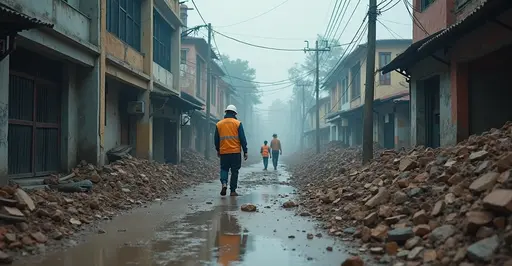
In a groundbreaking development that's transforming humanitarian aid delivery, artificial intelligence and satellite imagery are now working together to accelerate disaster response times from weeks to mere days. The World Food Programme's SKAI (Satellite Knowledge for AI) platform, developed in collaboration with Google Research, represents the cutting edge of this technological revolution.
How AI Mapping Works
The system uses advanced machine learning algorithms to analyze satellite imagery before and after disasters strike. By comparing these images, the AI can automatically assess building damage, identify affected regions, and predict where resources are most urgently needed. This technology can scan hundreds of thousands of buildings across thousands of square kilometers in just a few days, achieving accuracy rates exceeding 80%.
Real-World Impact
The effectiveness of this technology has been demonstrated in multiple major disasters. During the 2023 Türkiye-Syria earthquake, SKAI assessed approximately 600,000 buildings with 81% accuracy, identifying over 28,000 heavily damaged structures. In Hurricane Ian's aftermath, the system scanned 410,000 buildings across 3,000 sqkm within days, enabling aid organization Give Directly to deliver $2.1 million in cash assistance to 4,761 families weeks earlier than traditional methods would allow.
Pakistan Flood Response Breakthrough
Perhaps most impressively, during the devastating 2022 Pakistan floods described as "never seen climate carnage" by UN chief Antonio Guterres, SKAI scanned over 850,000 households across 8,000 km², directly benefiting approximately 2.5 million people. The system achieved precision rates of 80-85% in identifying damaged buildings, providing critical data that helped authorities verify ground survey findings and allocate resources more effectively.
Technical Capabilities
The AI system doesn't just identify damaged buildings—it can also detect specific infrastructure elements like solar panels and sanitation facilities, classify roof materials, and provide near-real-time monitoring of disaster-affected areas. This comprehensive approach enables organizations to combine damage assessment with population density data, infrastructure mapping, and socio-economic vulnerability information for truly targeted interventions.
Future Developments
SKAI is set to become the core technology of the upcoming Disha platform, a coalition led by UN Global Pulse that includes Google.org, McKinsey & Company, and multiple UN agencies. This integration will expand the reach and impact of AI-powered disaster response, driving greater efficiency and fostering collaboration among diverse stakeholders.
The technology represents a paradigm shift from reactive to proactive disaster response, potentially saving countless lives by ensuring aid reaches those who need it most, when they need it most.